Home › Blog › North Judson & West Lafayette Indiana Real Estate Guide Community Guide…
How Redlow Group Uses Drone Photography to Market Your Property
Seller Technology
Monticello, IN — White County
Monticello, IN — White County
Drone Photography Real Estate in Monticello, Indiana — How Redlow Group Markets Your Property
Aerial views, neighborhood context, cinematic video tours, and professional branding — a complete look at how Redlow Group uses drone photography real estate in Monticello, Indiana to sell properties faster and for more.
Michael Sims & Ryan Clemons
Co-Chairmen & Founders · Redlow Group
Published • Updated
Quick Answer
How does drone photography real estate in Monticello Indiana help sellers?
Drone photography real estate in Monticello Indiana helps sellers by capturing aerial views that showcase property layout, lot size, and neighborhood context in ways ground-level photography cannot. Furthermore, aerial video tours extend a listing’s reach across online platforms, attract out-of-town buyers, and generate stronger buyer engagement — which consequently leads to faster sales and more competitive offers.

Drone photography real estate in Monticello Indiana has become one of the most powerful tools available to home sellers — and Redlow Group uses it on every qualifying listing. According to the National Association of Realtors, listings with professional photography receive significantly more views than those without. Drone photography takes that advantage further by providing aerial context that standard photography simply cannot match. Additionally, Monticello’s position on Lake Shafer and Lake Freeman means that aerial footage of waterfront properties, lot boundaries, and lake access is especially valuable to buyers evaluating properties remotely.
Drone Photography for Monticello Real Estate — At a Glance
Aerial ViewsCaptures property layout, lot size, and neighborhood context no ground shot can show
Lake PropertiesMonticello’s lakefront and lake-access homes shine in aerial footage
Video ToursCinematic aerial video tours engage buyers and extend listing reach
Faster SalesDrone listings attract more qualified buyers and more competitive offers
How Redlow Group Uses Drone Photography Real Estate in Monticello Indiana
01
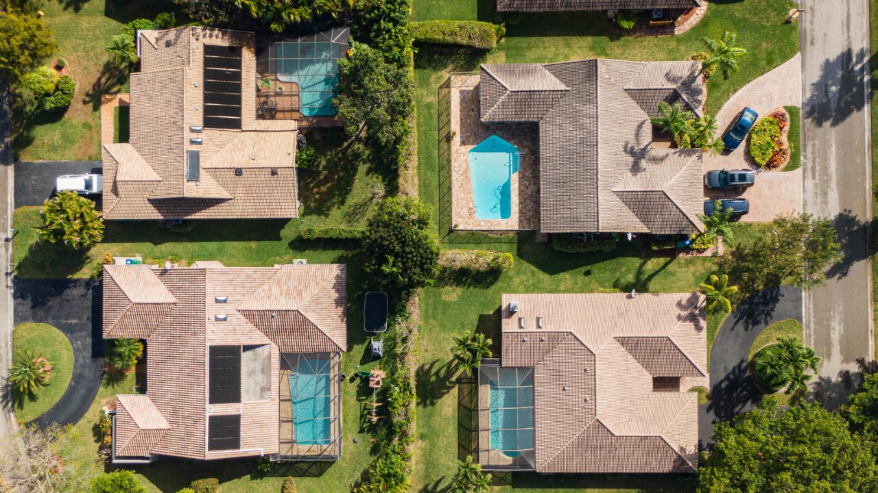
Stunning Aerial Views
Stunning Aerial Views
First and foremost, drone photography real estate in Monticello Indiana delivers aerial shots that highlight a property’s layout, surrounding landscape, and proximity to local amenities. Specifically, these shots capture wide views of the neighborhood — showing parks, schools, lakes, and community features that matter to buyers. Furthermore, because drone photography captures homes from angles that show the full property in context, it creates a stronger and more lasting impression than any ground-level shot can achieve.
🚁
Full Property ContextLot boundaries, outdoor space, neighborhood proximity — all captured in a single aerial frame.
Showcasing Large Properties and Unique Features
02
Showcasing Large Properties
Showcasing Large Properties
Additionally, for larger properties or estates in Monticello, drone photography is an essential tool. It allows Redlow Group to showcase expansive yards, gardens, and unique property features that ground-level photography cannot capture effectively. Buyers can see the full scope of the property — which is particularly helpful for those seeking outdoor space, pools, lake access, or large lots. As a result, buyers arrive at showings already understanding the property’s scale and layout.
🏡
Lake and Waterfront PropertiesMonticello’s lake access and waterfront homes are showcased most effectively from the air.
03
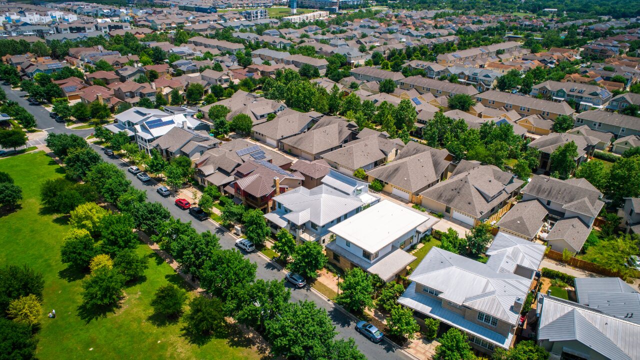
Highlighting the Neighborhood
Highlighting the Neighborhood
Furthermore, drone photography real estate in Monticello Indiana helps tell the story of a property’s location by capturing the neighborhood and nearby attractions. Specifically, aerial shots provide a clearer sense of proximity to parks, waterfronts, and community amenities than any map or ground photo can deliver. Buyers consequently get a genuine feel for the area and the lifestyle that comes with the home — which builds confidence and accelerates purchasing decisions.
🗺️
Location StorytellingParks, lakes, schools, and community context captured in a single aerial perspective.
Video Tours, Time Savings, and Professional Branding
04
Engaging Aerial Video Tours
Engaging Aerial Video Tours
In addition to still images, Redlow Group incorporates drone footage into virtual tours that give buyers an immersive property experience. Specifically, aerial videos take prospective buyers on a cinematic tour that highlights key areas and delivers a visual experience far beyond what static photos provide. Moreover, these videos appear in online listings, social media posts, and email campaigns — extending the reach of the property and drawing interest from a wider buyer pool. You can also see our full approach in our real estate marketing strategy guide.
🎬
Cinematic Property ToursAerial drone footage featured across listings, social media, and email campaigns.
05
Time-Saving for Buyers
Time-Saving for Buyers

Moreover, drone photography real estate in Monticello Indiana saves time for buyers by giving them a comprehensive property overview without requiring an in-person visit right away. Specifically, buyers can review high-quality aerial images and videos online and make an informed decision about whether the property warrants a showing. As a result, the buyers who do request showings are more serious and more prepared — which leads to fewer wasted showing appointments and faster offer timelines. For buyers also exploring Monticello’s specific neighborhoods, our Monticello neighborhoods guide provides deeper community context.
06
Professional Image and Branding
Professional Image and Branding
Finally, using drone photography reflects Redlow Group’s commitment to the latest marketing technology on behalf of every client. Specifically, it signals to buyers that the property is represented professionally — which builds listing credibility and attracts more serious inquiries. Furthermore, high-quality drone marketing materials help properties sell faster and for better prices. For sellers who also want immersive interior technology, our 3D photography guide for Monticello covers how virtual tours complement aerial drone footage.
🏆
Market LeadershipDrone photography positions your listing above the competition from day one.
Frequently Asked Questions — Drone Photography Real Estate Monticello Indiana
More Drone Photography Questions
Ready to List with Drone Photography Real Estate in Monticello Indiana?
Redlow Group combines drone photography, 3D virtual tours, professional staging, and targeted digital marketing to deliver outstanding listing outcomes for Monticello sellers. Drone photography is not an add-on — it is part of how we go to market.
- 1.Professional drone photography and aerial video for every qualifying listing
- 2.Integration across online listings, social media, and email campaigns
- 3.Aerial context that helps remote and out-of-town buyers evaluate your property
- 4.Full marketing coordination from first shoot through to closing
The Bottom Line on Drone Photography Real Estate in Monticello Indiana
Drone photography real estate in Monticello Indiana gives sellers a genuine competitive advantage — aerial views that showcase properties in full context, video tours that attract and engage remote buyers, and professional presentation that generates more qualified showings. For Monticello’s lakefront homes, large lots, and distinctive properties in particular, drone footage is not optional. It is the most effective way to communicate what makes a property special to the widest possible buyer pool.
In Monticello’s competitive real estate market, drone photography is the difference between a listing that gets noticed and one that gets overlooked.
Contact Redlow Group — Monticello Drone Photography Listings
Redlow Group — Monticello & White County Real Estate
Free Listing Consultation ·
Browse Monticello Listings
Free Listing Consultation ·
Browse Monticello Listings
·
·
More